Introduction
Garmin GPSMAP 742XS 7-inch Touchscreen Chartplotter/Sonar Combo
Model: 010-01738-03
UPC: 753759168230
- 7-inch high-resolution intuitive touchscreen controls
- NMEA 2000 and NMEA 0183 support for network connectivity
- Garmin Marine Network support for sharing sonar, including Panoptix sonar, maps, user data, radar and IP cameras among multiple units
- Preloaded U.S. LakeV g3 maps and BlueChart g3 charts
Experience an advanced navigation solution with this compact 7-inch GPSMAP 742xs touchscreen combo. Includes wireless connectivity features for the Garmin BlueLink mobile app, NMEA 2000 support and Garmin Marine Network capabilities for radar and Panoptix all-seeing sonar, including Panoptix FrontV collision avoidance sonar. It also has built-in Garmin CHIRP and CHIRP ClearV sonar (transducer sold separately).
Full-network compatibility allows you to add more capabilities to your boat. Garmin Marine Network support allows sharing of sonar, including Panoptix sonar, maps, user data, Garmin radar, and IP cameras among multiple units. Plus, theres NMEA 2000 and NMEA 0183 support for connectivity including autopilots, digital switching, weather, FUSION-Link, VHF, AIS and other sensors.
Enjoy built-in Wi-Fi and ANT wireless connectivity directly to quatix marine watch, Garmin Nautix in-view display, gWind Wireless 2 transducer, GNX Wind marine instrument and wireless remote controls. You can even stream and control a VIRB action camera from the chartplotter.
Right out of the box, you have access to some amazing sonar capabilities; all you add are transducers. Comes with built-in Garmin 1 kW CHIRP sonar and CHIRP ClearV scanning sonar. It even supports Panoptix all-seeing sonar, premium Garmin sonar modules and a wide range of transducers (sold separately).
Networked combos can share their internal sonar with any other device on the network. You can also choose what information is overlaid on the sonar screen, for example, radar, time of day or GPS speed.
Fast, responsive built-in 10 Hz GPS and GLONASS receiver refreshes your position and heading 10 times each second to make your movement on the screen more fluid. It makes dropping up to 5,000 accurate waypoints and finding your way back to them quick and easy.
LakeV g3 inland maps and BlueChart g3 coastal charts provide industry-leading coverage, clarity and detail with integrated Garmin and Navionics data and Auto Guidance1 technology. LakeV g3 and BlueChart g3 include Auto Guidance1, which uses your desired depth and overhead clearance to calculate routes and provide a suggested path to follow. LakeV g3 provides coverage on more than 17,000 lakes with up to 1 contours. BlueChart g3 also includes NOAA raster cartography, available as a free downloadable feature via the ActiveCaptain app. Additionally, they both offer easy-to-use features such as Depth Range Shading and Shallow Water Shading, which let you view your target depth to avoid running aground.
Accessory map purchases, such as LakeV g3 Ultra or BlueChart g3 Vision, add even more features and detail to your maps and charts. LakeV g3 Ultra and BlueChart g3 Vision add high-resolution relief shading, which provides an easy-to-interpret, clearer view of bottom structure than contour lines alone plus many other chart and map-enhancing features.
To help you gain a wind-maximizing competitive edge, your chartplotter features a pre-race guidance page that shows your virtual starting line along with data fields showing laylines, time to burn before the start and a race timer that can be synchronized across all your networked Garmin GPS products. In addition, other supported sailing features include an enhanced wind rose, heading and course-over-ground lines, set and drift, true and apparent wind data and more.
If you have waypoints, tracks or frequently used routes stored on another manufacturers GPS product or on a Garmin handheld device its easy to transfer those items to your new Garmin chartplotter via industry-standard GPX software formatting.
Specifications
| Physical and Performance |
| Physcial dimensions |
8.8″ x 5.6″ x 2.1″ (224.0mm x 142.5mm x 53.9mm) |
| Display size |
6.1″ x 3.4″ (154.08mm x 85.92mm) |
| Display resolution |
800 x 480 |
| Display type |
Multi-touch touchscreen WVGA display |
| Weight |
1.9lbs |
| Water rating |
IPX7 |
| Antenna |
Internal or external over NMEA 2000 |
| NMEA2000 compatible |
Yes |
| NMEA0183 compatible |
Yes |
| SiriusXM Weather & Radio compatible |
Yes |
| Mounting options |
Bail or flush |
| Garmin marine network ports |
1 |
| Maps and Memory |
| Preloaded maps |
BlueChart g3 (coastal maps) and LakeV g3 (inland maps) |
| Accepts data cards |
2 microSD cards |
| Waypoints |
5,000 |
| Routes |
100 |
| Track log |
50,000 points; 50 saved tracks |
| Chartplotter Features |
| Garmin Radar compatible |
Yes |
| Garmin Sonar compatible |
Yes |
| Garmin SmartMode compatible (customizable monitor presets) |
Yes |
| Supports AIS (tracks target ships position) |
Yes |
| Supports DSC (displays position data from DSC-capable VHF radio) |
Yes |
| Tide tables |
Yes |
| Garmin Meteor Audio System compatible |
Yes |
| Supports Fusion Lync compatible marine radios |
Yes |
| GSD Black Box sonar support |
Yes |
| GCV Black Box sonar support |
Yes |
| BlueChart Mobile (planning) compatible |
Yes |
| Garmin Helm compatible |
Yes |
| GRID (Garmin Remote Input Device) compatible |
Yes |
| Wireless remote compatible |
Yes |
| Connections |
| NMEA 0183 input ports |
1 (Differential) |
| NMEA 0183 output ports |
1 (Differential) |
| Video input ports |
1 BNC |
| Video output ports |
None |
| Wireless connectivity |
Yes |
| Sonar Features and Specifications |
| CHIRP sonar technology |
Yes (Built-in) |
| ClearV |
Yes with CHIRP (built-in) |
| SideV |
Yes (with external black box, sold separately) |
| Dual-frequency (50/200 kHz) sonar capable |
Yes |
| Dual-beam (77/200 kHz) sonar capable |
Yes |
| Frequencies supported |
Traditional sonar (50/77/83/200 kHz), CHIRP (low, medium, high), CHIRP ClearV (260/455/800 kHz) |
| Maximum depth |
5,000 ft at 1kW (depth capacity is dependent on water bottom type and other water conditions) |
| Bottom lock (shows return from the bottom up) |
Yes |
| Water temperature log and graph |
Yes |
| Sonar recording |
Yes |
| Sonar history rewind |
Yes |
What’s in the Box:
- GPSMAP 742xs chartplotter
- Power cable
- Bail mount kit with knobs
- Flush mount kit with gasket
- Protective cover
- Trim piece snap covers
- Documentation
GARMIN GPSMAP 742xs is brand new. GARMIN GPSMAP 742xs This compact 7-inch GPSMAP 742xs touch screen combination experience advanced navigation solutions. Including wireless connectivity for the Garmin BlueLink mobile app, NMEA 2000 support, and Garmin Marine Network for radar and Panoptix full-view sonar, including PanoptixFrontV collision avoidance sonar. It also has built-in Garmin CHIRP and CHIRPClearV sonar (sensors sold separately).
!!!!—-
PRODUCT ID: 1000498
SKU: NVN-1000498
CSKU: CWR-1000498
REWRITE: 1011609-garmin-gpsmap742xs-7inch-chartplotter
MPN: 010-01738-03
UPC: 753759168230
ASIN:
WSKU: GAR0100173803
SSKU:
KSKU:
GSKU:
MSKU:
LSKU:
NAME: Garmin GPSMAP 742XS 7-Inch Touchscreen Chartplotter/Sonar Combo
NAME_EX:
PTITLE: Garmin GPSMAP742XS 7 Plotter US Coastal No Transducer
TYPE: Marine Navigation & Instruments | GPS – Chartplotters
VENDOR: Garmin
Google Category:
Amazon Category:
Amazon Title:
Google Title: Garmin GPSMAP 742xs
Amazon Category:
Gtags:
GSpecs:
 FREE SHIPPING ON ORDERS OVER $30
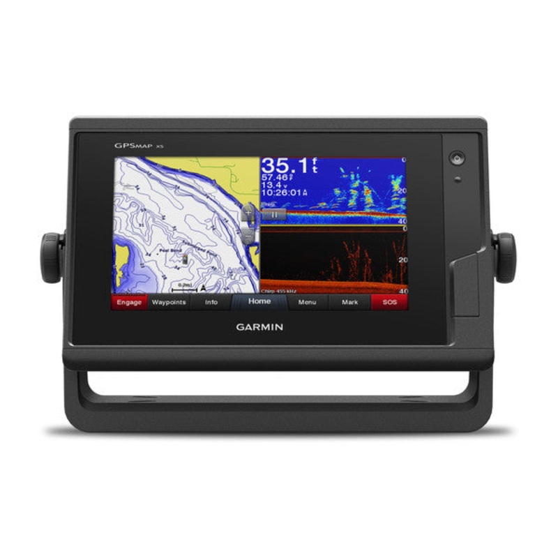 Sale!
Sale! 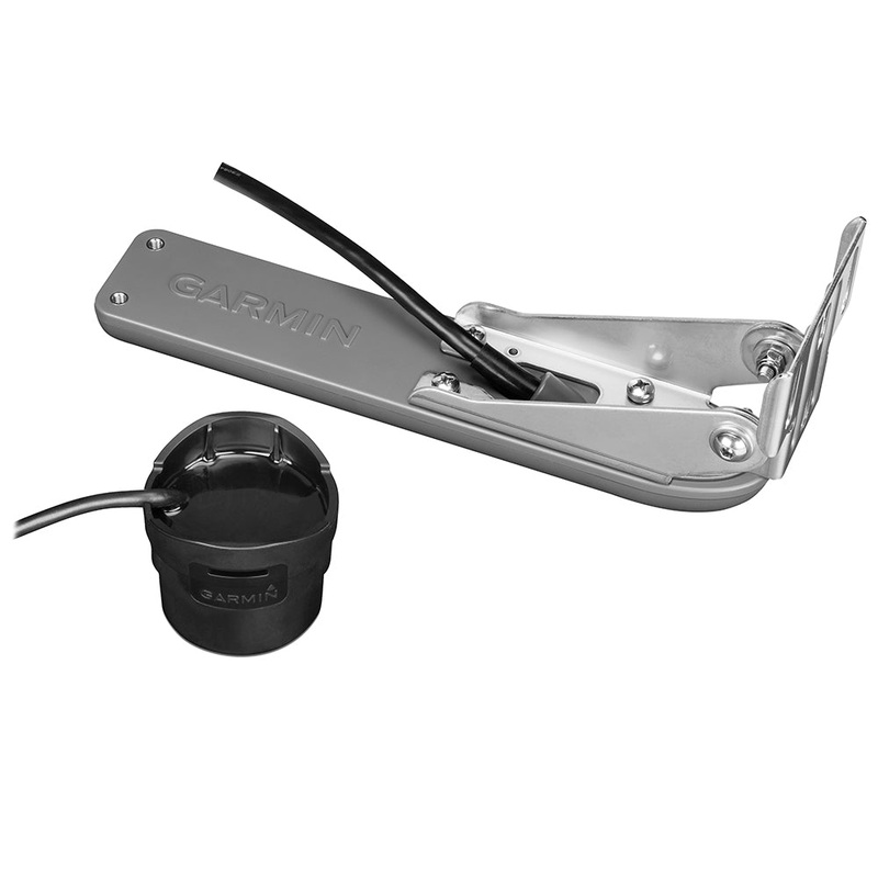
Reviews
There are no reviews yet.